Why Bangladesh Floods Every Year Without Exception
Bangladesh is the most downstream country in the Hindu-Kush-Himalayan region — the final point where three of Asia's mightiest river systems converge before emptying into the Bay of Bengal. The Ganges, the Brahmaputra-Jamuna, and the Meghna together drain a catchment area that spans India, Nepal, Bhutan, China, and Bangladesh itself. When monsoon rain falls across that entire basin — sometimes more than 2,000 kilometers north of Bangladesh's borders — the water has only one direction to travel. Downward. Into Bangladesh.
This is not a weather anomaly. It is the permanent geographic reality of a country that sits at the bottom of a continental drainage system. Around 80 percent of the water flowing through Bangladesh's rivers originates outside its borders. Bangladesh has no control over how much rain falls in India's northeastern states, in the Himalayan watersheds, or over the Bay of Bengal. It receives the accumulated runoff of an area many times its own size, compressed into a monsoon season that runs from June through September, through a flat river delta that sits less than five meters above sea level across most of its territory.
The result is structural flooding every single year. In a normal flood year, approximately 20 percent of Bangladesh's land area — around 31,000 square kilometers — is inundated. In a moderate flood year, that figure rises to 35 percent. In a major flood year, more than 60 percent of the country can be submerged, as occurred in 1998. The 83 percent of Bangladesh that is classified as floodplain is not a geological accident — it is the accumulated deposit of millennia of river sediment, land that exists because of flooding and that continues to exist within its reach. Roughly 60 percent of Bangladesh's 170 million people live in areas classified as high flood danger zones. That is not because they made a mistake. It is because the country's geography does not offer most of them an alternative.
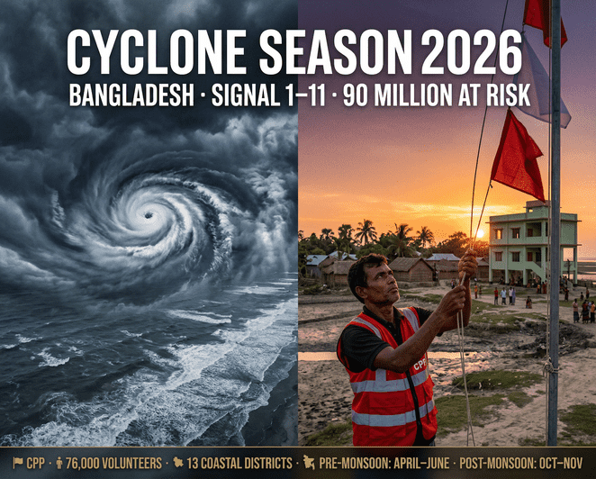
Bangladesh Cyclone Season 2026: Preparation Guide and Early Warning Signals
The Four Types of Flooding Bangladesh Faces
Bangladesh does not experience a single type of flood. It experiences four distinct flood categories that arrive through different mechanisms, affect different regions, and require different responses. Understanding the difference is essential to understanding why Bangladesh's flood problem is not simply a matter of building higher embankments.
Monsoon river floods are the most widespread and the most predictable. They are caused by the simultaneous peak flow of the Ganges, Brahmaputra-Jamuna, and Meghna systems during the monsoon season, combined with heavy rainfall within Bangladesh itself. The convergence of these three river systems in a flat, low-lying delta creates conditions where floodwaters from multiple sources overlap and compound each other. The 1988 and 1998 floods — both catastrophic monsoon river events — inundated more than 60 percent of the country. The 1998 flood claimed 2,379 lives, destroyed 3.2 million tonnes of crops, and caused financial losses estimated at 40,000 million taka.
Flash floods are a different threat. They occur primarily in northeastern Bangladesh — the Sylhet division, the haor wetland basin, and the districts bordering India's Meghalaya and Assam states. Flash floods are sudden, fast-rising, and often unrelated to local rainfall. They are triggered by extreme rainfall in the adjacent Indian hill states — when Meghalaya or Assam receives 200 to 400 millimeters of rain in 24 to 48 hours, that water arrives in Bangladesh's haor basin within hours. The June 2024 floods that struck Sylhet and Sunamganj districts — with Sylhet recording 242 millimeters and Sunamganj 223 millimeters of rainfall in a single period, both exceeding monthly averages — illustrated the flash flood pattern precisely. Within days, nearly 75 percent of Sylhet district was under water, with 825,000 people directly affected in Sylhet alone and 560,000 more in Sunamganj.
Coastal and storm surge flooding affects the 13 coastal districts that face the Bay of Bengal. This type of flooding is driven by cyclones and low-pressure systems that push seawater inland — sometimes combining with river flood water arriving from upstream simultaneously. The 1991 cyclone and its associated surge, the 2007 Cyclone Sidr, and the 2024 Cyclone Remal all produced coastal flooding that combined tidal surge with inland river overflow. The Sundarbans mangrove forest provides partial protection for the southwestern coast, but the eastern and southeastern coast — Cox's Bazar, Chattogram, Noakhali — has no equivalent natural buffer.
Rainfall-induced urban flooding is the fourth category and the fastest-growing threat. Dhaka, Bangladesh's capital city and home to more than 22 million people, was built largely on floodplain. Rapid unplanned urbanization has pushed residential settlements into low-lying wetlands and water retention areas known as khals. NASA research has documented how informal settlements in areas like Korail — where homes are built on stilts over a lake — face worsening monsoon season floods as natural water absorption capacity is destroyed by construction. As climate change intensifies monsoon rainfall, urban flood frequency and severity in Dhaka is projected to increase substantially through 2070.
The 2024 Flood Season: What Happened Across Five Months
The 2024 monsoon season was among the most damaging in recent years, compressing multiple flood events into a single season that began with Cyclone Remal in May and ended with flash floods in the northeast in October. The UN's Humanitarian Response Plan estimated that 18 million people were affected across the full 2024 flood season — a number that represents more than one in ten Bangladeshis.
The sequence began on May 26, 2024, when Cyclone Remal made landfall with wind speeds up to 102 kilometers per hour. UNICEF estimated 4.6 million people were affected by Remal directly. Within days, heavy rainfall in India's Meghalaya and Assam states sent flash flood waters into Bangladesh's northeast, triggering the first of multiple haor region inundations. By mid-June, Sylhet district was 75 percent under water.
The Jamuna River basin — the floodplain districts of northern Bangladesh including Kurigram, Gaibandha, Jamalpur, Sirajganj, and Tangail — flooded from mid-July as monsoon rainfall pushed the Brahmaputra-Jamuna system above danger levels at multiple stations. The Flood Forecasting and Warning Centre estimated that 5.13 million people in the Jamuna basin faced potential inundation, including 1.5 million school-age children and over 80,000 persons with disabilities.
In August, the most severe event of the season struck the southeast. Flash flooding inundated 11 northeastern and southeastern districts simultaneously. By August 30, the National Disaster Response Coordination Center confirmed 5.8 million people had been affected in the northeastern and southeastern regions, with over one million people cut off in flooded communities and 502,501 displaced into evacuation shelters. Over 7,000 schools closed, affecting 1.75 million primary students. Agricultural losses were severe — 296,852 hectares of crops were damaged, fisheries losses reached USD 122 million, and livestock losses totaled USD 34 million in initial estimates. The Centre for Policy Dialogue's total damage estimate for the August floods alone reached Tk 144 billion — approximately USD 1.2 billion.
In October, flooding in Meghalaya's hill regions again triggered downstream inundation in Sherpur, Mymensingh, and Netrokona districts. Over 60,000 families were displaced, 11 people killed, and 92,000 hectares of farmland damaged, with losses estimated at 1,144 crore taka.
Bangladesh Remittance 2026: $22 Billion in 8 Months — Diaspora Breaks Records Again
The Districts That Flood First: Bangladesh's High-Risk Geography
Bangladesh's flood risk is not evenly distributed. Historical data, river hydrology, and elevation mapping identify specific districts and divisions that flood earliest, most severely, and most frequently.
The Sylhet Division — covering Sylhet, Sunamganj, Moulvibazar, and Habiganj districts — is Bangladesh's primary flash flood zone. The haor basin, a network of bowl-shaped floodplain wetlands that covers much of the region, naturally collects water during flood events. In extreme years, 90 percent of Sylhet division can be submerged, as occurred during the 2022 flash floods. The region floods before the rest of Bangladesh — as early as April in pre-monsoon flash flood events — and the flood waters recede slowly due to the haor basin's topography.
The Jamuna River corridor — Kurigram, Gaibandha, Jamalpur, Sirajganj, Bogura, Tangail, and Manikganj — floods annually as the Brahmaputra-Jamuna peaks in July and August. These districts contain extensive char lands: river islands formed by sediment deposition that are fertile but flood-exposed. Millions of people live on chars with no permanent flood protection infrastructure. When the Jamuna river station at Sirajganj crosses danger level — an event that occurs most years — the flood front moves rapidly across low-lying areas on both banks.
The Ganges-Padma corridor — Rajshahi, Faridpur, Rajbari, Manikganj, and Munshiganj — floods when the Ganges system peaks, typically in August and September, often overlapping with the Jamuna flood. The 1998 flood's catastrophic scale was partly caused by the simultaneous peaking of all three river systems within the same two-week window — a coincidence that climate projections suggest will occur more frequently as monsoon patterns intensify.
The southeastern districts — Feni, Noakhali, Cumilla, Chattogram, Rangamati, Khagrachari, and Bandarban — are exposed to both flash flooding from the Chittagong Hill Tracts and cyclone-driven coastal flooding. The August 2024 floods that cut off over a million people were concentrated in these districts. Feni district, which lies at the outlet of the Feni River, experienced near-total inundation, with a study of Feni's 2024 flood finding that 99.3 percent of respondents reported livelihood disruption and over 85 percent reported moderate to severe psychological distress in the aftermath.
What Flooding Costs Bangladesh Every Year
The economic cost of Bangladesh's annual flooding is measured in multiple dimensions — crop losses, infrastructure damage, livestock deaths, school closures, and the long-term disruption to livelihoods that takes months or years to recover from.
Agriculture bears the highest direct cost. Bangladesh's primary rice crop — aman rice — is planted between July and August and harvested between November and December. It grows entirely on rainfall and is therefore directly exposed to peak monsoon flooding. When floods arrive in August or September, they arrive precisely during the aman rice growing period. The 2024 floods caused a production loss of over half a million tonnes of rice, according to the Food and Agriculture Organization. Since nearly two-thirds of Bangladesh's farming households depend on aman rice production, a single bad flood year translates directly into food insecurity, debt, and reduced income for tens of millions of rural families.
Fisheries and aquaculture are the second major economic casualty. Bangladesh's fish pond infrastructure — essential to both rural protein supply and export earnings — is destroyed when flood water overtops or breaches pond embankments and fish stocks are lost. In the August 2024 floods, fisheries losses reached USD 122 million in initial estimates, a figure that does not capture the full-season impact of fish stock replacement, pond rehabilitation, and lost production time.
Infrastructure damage accumulates year-over-year. Road networks, embankments, bridges, and culverts that are damaged by floods are repaired, then damaged again the following season. Bangladesh's rural road network is particularly vulnerable — the 2024 eastern flash floods alone damaged 462 kilometers of roads across 12 districts. Schools and health facilities that double as evacuation shelters are repeatedly damaged, disrupting education calendars and healthcare access during and after each flood event.
The human cost beyond mortality is significant. Income loss, psychological distress, displacement, and the disruption of children's education are effects that compound over time. A study published in Scientific Reports examining the 2024 Feni district floods found that households with lower incomes were significantly more likely to experience both livelihood disruption and severe psychological distress — a pattern consistent with research across multiple flood events, which consistently shows that the most economically vulnerable populations bear a disproportionate share of flood costs.
The Early Warning System: What Works and What Doesn't
Bangladesh's Flood Forecasting and Warning Centre (FFWC) operates a network of river monitoring stations across the country, measuring water levels at 93 key points and issuing danger level alerts when major rivers approach or exceed thresholds. The FFWC's forecasting model, which draws on rainfall data from upstream catchment areas in India and integrates satellite imagery, can provide 72-hour advance warning of significant monsoon river flooding in the Jamuna and Ganges corridors.
For flash floods in the northeast, the lead time is much shorter. When Meghalaya or Assam records extreme rainfall, Bangladesh's haor districts may have less than 12 to 24 hours before flood water arrives. The FFWC and Bangladesh Meteorological Department jointly issue early warnings, but the dissemination challenge — reaching communities in remote haor areas that may already have limited connectivity — remains significant. During the 2024 June floods, the FFWC issued warnings, but the speed and scale of inundation in Sylhet division still overwhelmed local response capacity within 48 hours.
The OCHA-coordinated Anticipatory Action framework, now in its 2025 version, represents an evolution in Bangladesh's flood management approach. Rather than responding to floods after they happen, the anticipatory action model pre-positions cash assistance, food, hygiene kits, and emergency supplies in high-risk areas before a flood trigger threshold is crossed. In 2024, anticipatory action funding from the Central Emergency Response Fund (CERF) along with UNICEF, FAO, and WFP provided approximately USD 8.5 million to assist over 600,000 people in anticipation of Jamuna basin flooding — before the water arrived. The model has demonstrated measurable impact in reducing loss of life and livelihood disruption compared to pure response-after-event approaches.
The gap that the anticipatory action model cannot close is the structural one. Bangladesh's flood exposure is not a problem that better forecasting can solve. The Ganges, Brahmaputra, and Meghna will continue to carry the monsoon runoff of an entire subcontinent into Bangladesh every year. Climate change is making that runoff more intense, less predictable, and more likely to exceed historical flood benchmarks. The IPCC projects that peak monsoon inflows from the Ganges will increase by 10 percent and from the Brahmaputra by 5 percent by 2080 — increases that, combined with sea-level rise, will produce flood levels in coastal areas exceeding the 1998 benchmark.
The 2026 Monsoon Season: What to Watch and When
The 2026 monsoon season will follow the same structural pattern as every year before it. The pre-monsoon flash flood risk in the haor region begins in April. The main monsoon arrives in June and intensifies through July and August. The Jamuna basin flood peak is typically in late July to early August. The Ganges-Padma peak follows in August to September. Cyclone risk overlaps with the monsoon from June through November.
The districts to watch first in 2026 are the same as in every previous year: Sylhet and Sunamganj for pre-monsoon and early monsoon flash floods; Kurigram, Gaibandha, Jamalpur, and Sirajganj for Jamuna corridor flooding; Faridpur, Rajbari, and Munshiganj for Ganges-Padma flooding; and Feni, Noakhali, Cumilla, and Chattogram for southeastern flash and coastal flooding.
The Flood Forecasting and Warning Centre updates river level data daily at ffwc.gov.bd. During active flood periods, FFWC publishes flash flood bulletins every 24 hours. The Bangladesh Meteorological Department issues heavy rainfall warnings — the primary trigger for flash flood risk in the northeast — at bmd.gov.bd. Anyone living in or near a haor district, Jamuna corridor, or southeastern hill-adjacent area should monitor these sources from April onward.
Household flood preparation follows many of the same principles as cyclone preparation: an emergency kit with three to five days of dry food, drinking water or purification tablets, a battery-powered radio, waterproof document storage, and knowledge of the nearest elevated structure or flood shelter. In haor areas, a boat or access to a boat is a practical necessity for many households during severe flood years. In Jamuna corridor districts, knowing which roads remain passable during flood season — and which do not — is information that can determine whether a family can access healthcare and markets when river levels peak.
Bangladesh's relationship with flooding is not a crisis to be solved. It is a permanent condition to be managed, prepared for, and — in the case of small-scale seasonal flooding — partially absorbed as the agricultural system has done for centuries. The 2026 season will bring flooding. The question is whether the country's institutions, communities, and individual households are positioned to respond faster, smarter, and with fewer lives lost than the year before.
win-tk.org is a WinTK publication.