A Country Built at Sea Level — and Below It
Two-thirds of Bangladesh sits less than 15 feet above sea level. This is not an approximation — it is a physical measurement of a country built on the accumulated sediment of three of Asia's largest rivers, deposited over millennia into a flat, low-lying delta at the northern end of the Bay of Bengal. The average elevation of Bangladesh is nine meters above sea level, but that average conceals a distribution that places the majority of its territory, agriculture, and urban population within striking distance of a sea that is rising faster here than the global mean.
Bangladesh has a 720-kilometer coastline. Approximately one-third of its population lives in coastal districts. The country's southern and southwestern geography — Khulna, Satkhira, Bagerhat, Barguna, Patuakhali, Barisal, Bhola, and the Sundarbans mangrove belt — lies at or near tidal influence even under current sea level conditions. The country contributes less than 0.3 percent of global greenhouse gas emissions. It ranks among the ten countries most exposed to the consequences of the climate change it did not cause.
In 2026, as Bangladesh graduates from Least Developed Country status and positions itself as a middle-income economy, the physical geography beneath that economic trajectory tells a different story. Sea levels along the Bangladesh coast are rising at an average rate of 4.58 millimeters per year — faster than the global mean sea level rise of 3.7 millimeters per year measured between 2006 and 2018. Along the eastern Chattogram coastal plain, the rate reaches 4.73 millimeters per year, the highest in the country. And underneath the rising ocean, Bangladesh's land is simultaneously sinking.
Bangladesh Flood Risk 2026: The Population in Danger
Why Sea Level Rise in Bangladesh Is Worse Than the Global Average
Global sea level rise figures — often cited in the range of 3 to 4 millimeters per year — capture what is happening to the ocean surface. What they do not capture is what is happening to Bangladesh's land surface simultaneously. Bangladesh's coastal zone experiences what scientists call relative sea level rise: the combined effect of the ocean getting higher and the land getting lower. Both are happening at the same time, and their effects compound each other.
Land subsidence in Bangladesh has multiple causes. The delta itself naturally compacts over time as the weight of sediment presses down on the layers below. The Ganges and Brahmaputra deliver approximately 1.6 billion tonnes of sediment annually to the delta face, which historically offset natural subsidence and kept the delta relatively stable. That sedimentation buffer has weakened as upstream dam construction in India has reduced sediment flow by an estimated 10 million tonnes per year, meaning less natural replenishment reaches the coastal zone.
Groundwater extraction is a compounding factor. As urban populations grow and rural agricultural demand for irrigation increases, groundwater is extracted from aquifers beneath the delta. Removing that subsurface water causes the overlying land to sink. In Dhaka, local measurements have recorded subsidence rates of 1 to 2 centimeters per year in specific areas — rates that dwarf the ocean's rise in terms of local relative sea level change. Across the delta more broadly, relative sea level rise rates of 4 to 7.8 millimeters per year have been measured at different stations, and the Ganges delta as a whole has recorded a mean sea level shift of 26 centimeters at an average rate of 11.6 millimeters per year over the past two and a half decades.
A study published by The Daily Star in October 2025, drawing on research published in the journal Geomatics, Natural Hazards and Risk, documented the geographic variation in subsidence and sea level rise across Bangladesh's three coastal zones. The eastern coast — centered on the Chattogram coastal plain — is sinking faster than the central and western coasts, driven by higher tidal range, infrastructure construction pressure, and deep piling for development projects. The western coast, partially protected by the Sundarbans mangrove forest, has experienced less human-driven subsidence. The Meghna estuarine floodplain in the center records the slowest relative rise at 2.4 millimeters per year, but still above the global mean in absolute terms. The implication, as the research makes clear, is that blanket national sea level rise policies will be insufficient — the risk profile differs significantly across Bangladesh's three coastal zones.
When land subsidence is incorporated into sea level rise projections rather than using only ocean surface rise estimates, the picture for Bangladesh changes substantially. Research published in The Business Standard found that water-level rise in Bangladesh's delta could reach 85 to 140 centimeters by the end of this century — approximately twice the projections provided in the IPCC's standard reports, which did not adequately account for local land subsidence.
The Projections: What Different Scenarios Mean for Bangladesh
The IPCC's Sixth Assessment Report projects global mean sea level rise of between 43 centimeters and 84 centimeters by 2100 under moderate to high emission scenarios. Under the highest emission scenario (SSP5-8.5), the global mean rises to between 63 and 101 centimeters. For the Bay of Bengal specifically, estimates suggest the rise may reach approximately 77 centimeters under a high emission scenario. When land subsidence is added to these projections for Bangladesh's delta, the effective water level rise at the coast reaches 85 to 140 centimeters by 2100.
Research by the Bangladesh Department of Environment using satellite altimetry data, conducted with the Institute of Water and Flood Management at BUET and the Centre for Environmental and Geographic Information Services, projects sea level rise of 14 centimeters by 2030, 32 centimeters by 2050, and 88 centimeters by 2100 along the Bangladesh coastline. These projections translate into specific land loss estimates: sea level rise-induced flooding will cover between 12.34 and 17.95 percent of Bangladesh's coastal zone area by 2100.
The districts identified as most vulnerable in all future scenarios are consistent across multiple studies: Jhalakathi, Pirojpur, and Barisal — districts in the southwestern delta that lack comprehensive polder protection and sit at elevations that even moderate sea level rise can permanently inundate. Bagerhat, Barguna, Bhola, Chandpur, Chattogram, Cox's Bazar, Feni, Gopalganj, Jashore, Khulna, Laxmipur, Narail, Noakhali, Patuakhali, Satkhira, and Shariatpur are all identified as districts facing significant sea level rise-induced flooding by 2100.
A study published in Scientific Reports using GIS-based modeling of IPCC AR6 scenarios estimated that between 0.8 and 2.8 thousand square kilometers of Bangladesh's land may be permanently inundated by sea level rise by 2150, affecting between 0.5 and 2.8 million people in direct inundation terms. These figures represent only the land permanently lost below the waterline — they do not include the far larger populations affected by increased flood frequency, storm surge amplification, salinization, and reduced agricultural productivity in areas that remain nominally above sea level but become functionally compromised.
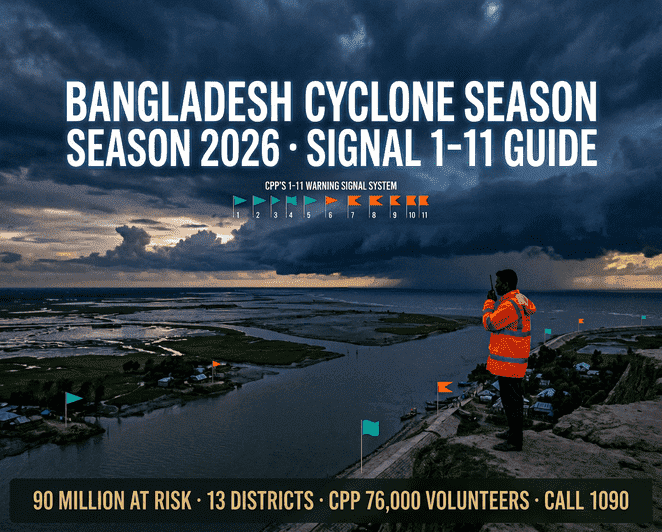
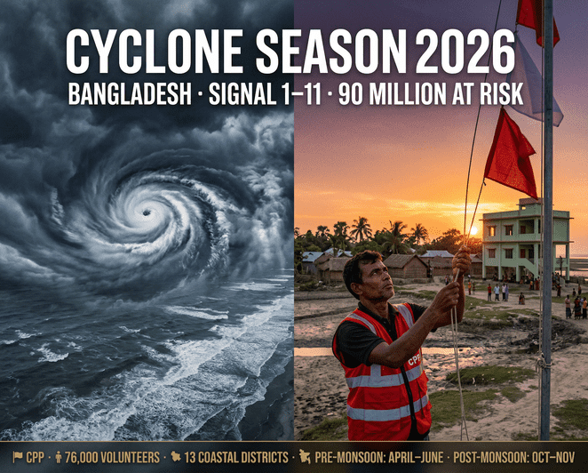
Bangladesh Cyclone Season 2026: Preparation Guide and Early Warning Signals
Salinity Intrusion: The Invisible Damage
Sea level rise does not only threaten land by submerging it. It threatens land by salting it. As the ocean rises and tidal influence extends further inland, saline water moves deeper into the river system, raising salt concentrations in rivers, groundwater, and eventually agricultural soil. This process — salinity intrusion — is already well underway in coastal Bangladesh and represents the slow-motion counterpart to the dramatic floods that make news.
In 1973, approximately 8.3 million hectares of Bangladesh's land area were affected by saline water intrusion. By 2009, that figure had grown to over 105.6 million hectares — an increase of more than tenfold in 36 years, according to Bangladesh's Soil Resources Development Institute. Overall soil salinity in Bangladesh has increased by approximately 26 percent over the past four decades. Climate projections indicate that rising salinity could affect 27 percent more coastal farmland by 2100, directly threatening food production in a region where agriculture employs more than one-third of the working population.
The Ganges tidal floodplain in southwestern Bangladesh — covering the coastal districts of Khulna, Satkhira, and Bagerhat — has already experienced significant salinization. Shrimp farming, which expanded rapidly in the region from the 1980s as farmers converted rice paddies to brackish water aquaculture, has accelerated the spread of salt into previously freshwater agricultural land. The economic logic of shrimp farming over rice production reflected immediate income pressures rather than long-term land management. The result is that large areas of southwestern Bangladesh are now difficult or impossible to return to rice cultivation, even where families would prefer to do so.
Salinity in drinking water is a separate and severe health threat. Elevated salt concentrations in groundwater have been linked to hypertension, increased cardiovascular disease risk, and adverse maternal health outcomes in coastal Bangladesh. For pregnant women and infants, saline drinking water poses documented health risks that compound the broader vulnerability of coastal households already exposed to flood damage, income loss, and food insecurity.
The Sundarbans: Bangladesh's Natural Shield Under Threat
The Sundarbans — the world's largest contiguous mangrove forest, straddling the southwestern coast of Bangladesh and the eastern coast of India — is simultaneously Bangladesh's most important natural buffer against sea level rise and one of its primary victims. The forest covers approximately 6,500 square kilometers on the Bangladesh side, provides habitat for the Royal Bengal Tiger and hundreds of species of flora and fauna, and serves as a UNESCO World Heritage Site. Its ecological and economic significance extends well beyond its formal boundaries.
As a physical structure, the Sundarbans absorbs cyclone energy, reduces storm surge penetration into coastal areas, and maintains a natural buffer between the Bay of Bengal and Bangladesh's southwestern agricultural heartland. The 2024 Cyclone Remal's relatively lower death toll in the western coastal districts — compared to its eastern impact — was partly attributed to the Sundarbans' buffering effect. As climate scientists note, if the Sundarbans degrades or disappears, the southwestern coastal zone loses its natural protection and becomes directly exposed to the full force of Bay of Bengal cyclones and storm surges.
The Sundarbans' current mean elevation is approximately 2 meters above mean sea level — a margin that sea level rise projections indicate is shrinking. Research on the Sundarbans estimates that under a net subsidence rate of 2.4 millimeters per year relative to the baseline year 2000, mangrove areas of 2,646 hectares, 9,599 hectares, and 74,720 hectares would be inundated and lost by the end of the 21st century under low, medium, and high sea level rise scenarios respectively. Under high emission scenarios, up to 23 percent of the Sundarbans' area could be flooded. The forest has already lost approximately 17,000 hectares since 1970 — loss attributable to a combination of rising salinity, tidal inundation, and human encroachment.
The cascading implications of Sundarbans loss extend into fisheries, timber, honey production, and the livelihoods of hundreds of thousands of people in Khulna, Satkhira, and Bagerhat who depend on the forest economy. They also extend into cyclone risk calculations for the entire southwestern coast. The removal of the Sundarbans buffer without equivalent built infrastructure protection would expose coastal communities to cyclone impacts of a scale that current disaster preparedness systems are not designed to handle.
Displacement and the Climate Migration Already Happening
Bangladesh's climate displacement is not a future scenario. It is a present reality that has been accelerating for decades and will accelerate further as sea level rise, salinity, and flood frequency increase through the remainder of this century.
Over the past decade, an average of nearly 700,000 Bangladeshis were displaced each year by natural disasters, according to the Internal Displacement Monitoring Centre. That annual average is driven upward by years with major cyclones — 2020's Cyclone Amphan displaced 500,000 families from coastal communities in a single event. But the slow-onset displacement driven by salinity, waterlogging, and chronic flooding is less visible in disaster statistics because it happens gradually, household by household, over years rather than days.
Coastal communities in Khulna, Satkhira, and Bagerhat have documented patterns of seasonal and permanent out-migration driven by a combination of cyclone damage, loss of agricultural productivity to salinity, and the increasing frequency of high-tide flooding events. In areas where the combination of saline water intrusion and flood frequency has made rice cultivation no longer viable, families have two choices: adapt to a different livelihood or leave. The cities receiving these internal migrants — primarily Dhaka and Khulna — are ill-prepared for the scale of the inflow, with informal settlements expanding into low-lying areas that are themselves flood-prone.
The UN predicts that over the next decade, approximately 17 percent of Bangladeshis may need to relocate if global warming continues at current rates. Some scientific projections of a five to six foot sea level rise by 2100 estimate displacement of up to 50 million people from Bangladesh alone — a number that would represent the largest climate-driven migration in human history. A 2018 US government report found that 90 million Bangladeshis — 56 percent of the population at that time — lived in high climate exposure areas, with 53 million subject to very high exposure.
What Bangladesh Is Doing — and What It Cannot Do Alone
Bangladesh has allocated 6 to 7 percent of its annual national budget to climate adaptation — an extraordinary commitment for an economy at Bangladesh's income level, and one that has produced tangible results. The Cyclone Preparedness Programme has reduced cyclone death tolls from six-digit levels in the 1970s to the low thousands in recent major events. The embankment and polder system, which covers approximately 4,000 kilometers of coastal protection infrastructure, has held significant areas of agricultural land above tidal inundation for decades. Floating agriculture in waterlogged areas, saline-tolerant crop varieties, and community mangrove reforestation programs represent locally developed adaptations to sea level rise impacts.
The government's Delta Plan 2100, a long-term national planning framework, identifies sea level rise and coastal salinity as central challenges requiring systematic infrastructure investment, governance reform, and climate-resilient urban planning. Projects under the plan include embankment rehabilitation, tidal river management, polder management reform, and ecosystem-based adaptation through mangrove restoration.
But adaptation has structural limits. Bangladesh can build higher embankments and plant more mangroves. It cannot raise the elevation of its delta or stop the ocean from rising. The International Centre for Climate Change and Development (ICCCAD) has stated directly: Bangladesh can implement the most advanced adaptation measures available, but without strong international action to reduce global emissions, millions will remain at risk. The choices made in emission reduction decisions by the world's major emitters — nations that have historically contributed over 70 percent of cumulative global carbon emissions — will determine more of Bangladesh's physical future than any adaptation investment Bangladesh can make independently.
In 2026, Bangladesh is graduating from Least Developed Country status and entering a new phase of its economic trajectory. That graduation carries trade and aid implications that will shape the resources available for climate adaptation. It also intensifies the urgency of the question that Bangladesh has been asking, with increasing sophistication and institutional capacity, for two decades: who pays for the consequences of emissions they did not produce, in a country that two-thirds of which sits less than 15 feet above a sea it did not cause to rise?
win-tk.org is a WinTK publication.